skip to main |
skip to sidebar
Almost two months ago I took two friends from Toronto to these two locations for a hike. This weekend I had my friend M.A.C. from London come up for a hike, so went here again.
Looking out over Cootes Paradise towards Hamilton and Lake Ontario.
Looking out over Borer’s Gorge towards Dundas and Ancaster.
My pack.
Borer’s Falls, also known as Rock Chapel Falls.
Approaching the edge of Borer’s Falls. (photo taken by M.A.C.)
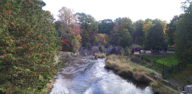
Looking out over Borer’s Gorge, atop the falls.
Standing at the top of Borer’s Falls.
Looking down into Borer’s Gorge.
Blue markers on the Bruce Trail indicate side trails, this one being Ray Lowe’s side trail. He was one of the people who came up with the idea for the Bruce.
Webster’s Falls.
Webster’s Falls.
Webster’s Falls.
Spencer Gorge, looking towards the mouth, Dundas Valley and the other side of the Niagara Escarpment beyond that.
Exploriment. (photo taken by M.A.C.)
Tew’s Falls.
Dundas.
My hiking companion, M.A.C.
Spencer Gorge, looking back towards the source.
Hamilton on the left, Dundas and Ancaster in front and to the right.
Borer’s Creek is one of the many water courses that tumbles over the Niagara Escarpment. Many dozens in the Hamilton city limits. Some of them are accessible by people in wheel chairs, with viewing platforms, others are only accessible after a strenuous hike. Borer’s Falls falls into the latter category.
It’s categorized as a “Plunge Ribbon Falls” and is 15 metres high, 5 metres wide.
Like most of them, Borer’s was exploited by early settlers to power industry. Also known as Rock Chapel Falls, the Falls powered a saw mill run by the Borer family for over a hundred years during the 19th century. Eventually as land was cleared, the creek’s flow was altered to such an extent that it was no longer a strong energy source, and the Borers switched to steam power for the mill.
For more info on Hamilton’s waterfalls, visit:
http://www.cityofwaterfalls.ca
These photos were taken over the course of a few different hike’mups, some in the fall of 08 and some in the spring of 09.
(Some other photos of this area in summer can be found here.) Heading towards Borer’s C.A..
Pivoting a little to the right. The dip where the telephone pole is, is where Borer’s Falls are.
And this is what I see when I turn 180°. Niagara Escarpment on the other side of the valley.
This view is from atop the Escarpment, looking in the direction of Dundas.
Borer’s Falls in winter.
After going around to the other side of the gorge, this is the view out across Cootes Paradise, with Hamilton beyond that.
Some views of the forest.
No one was home.
I decided to explore up the gorge and check out the falls from the bottom. The creek was roiling with spring snow melt. Quite a long and technical hike to get to the falls, with some steep hill sides, scrubby brush, and big boulders to clamber over.
I love the fact that an hours walk from my house, in what I think technically qualifies as within the confines of a major metropolitan area, is this rugged, roaring river. And not only that, but it’s secluded and I suspect rarely accessed by people.
Almost stepped on him.
Waterfalls are amazing at any time, but it was particularly satisfying to get to this spot, after an ass kicker of a trek.
I had the thought of cutting away the brush behind the trillium to get an unobstructed view of it and the falls behind it, but that struck me as too obnoxious.
The trek back was no less technical, but I went back on the opposite side of the creek and this side was bursting forth with trilliums, the flower of Ontario.




 Posts
Posts


