skip to main |
skip to sidebar
Went for a walk down to the Valley Inn Road bridge and back on a Friday night, before stopping in the spot in the cemetery where I do calisthenics. Windy and cold, but the light was gorgeous. And other than about a half dozen people walking their dogs in Dundurn Park, didn’t see anyone. (Cars passing by don’t really count.)
The cockpit and Dundurn Castle.
Dundurn Castle and the promenade.
The promenade.
Burlington Bay.
Gnarly roots.
The coach house.
Burlington Bay.
Burlington Bay and Carroll’s Point.
Moon over Hamilton.
Moon over Hamilton.
Looking back towards the High Level Bridge. The restored turtle habitat on the right.
My phone takes lousy night time shots, but I kinda dig the weird scuz in the night sky it creates. Looking out across Cootes Paradise.
I’ve been heading down to check out the rail bridge construction going down by the Desjardins Canal a few times in the last few months. Received a gift of a hike enhancer and went for a wander.
Dundas Peak in the distance.
Princess Point.
High Level Bridge.
The view from atop the bridge.
Some views of the ongoing construction as the prepare to put in the bridge.
360° view from atop the bridge before heading down the stairs.
The view across the road.
Cross over again and head down.
Cootes Paradise on the other side.
About halfway down the stairs.
Looking up. The area in the middle is where the new bridge is going to go. The stone abutment on the right is still the original ones put in in the middle of the 19th century. They were there at the time of the 1857 train disaster.
A view from one end of the canal, from the Burlington Bay side.
And the view if I turn 180°.
Merganser.
Looking down the canal from the other end, the Cootes Paradise side.
You have been warned.
Views of the Cootes Paradise side of the canal, with the fishway that keeps carp out.
Ground level views of Cootes Paradise.
Almost two months ago I took two friends from Toronto to these two locations for a hike. This weekend I had my friend M.A.C. from London come up for a hike, so went here again.
Looking out over Cootes Paradise towards Hamilton and Lake Ontario.
Looking out over Borer’s Gorge towards Dundas and Ancaster.
My pack.
Borer’s Falls, also known as Rock Chapel Falls.
Approaching the edge of Borer’s Falls. (photo taken by M.A.C.)
Looking out over Borer’s Gorge, atop the falls.
Standing at the top of Borer’s Falls.
Looking down into Borer’s Gorge.
Blue markers on the Bruce Trail indicate side trails, this one being Ray Lowe’s side trail. He was one of the people who came up with the idea for the Bruce.
Webster’s Falls.
Webster’s Falls.
Webster’s Falls.
Spencer Gorge, looking towards the mouth, Dundas Valley and the other side of the Niagara Escarpment beyond that.
Exploriment. (photo taken by M.A.C.)
Tew’s Falls.
Dundas.
My hiking companion, M.A.C.
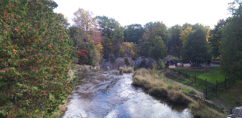
Spencer Gorge, looking back towards the source.
Hamilton on the left, Dundas and Ancaster in front and to the right.




 Posts
Posts


